Course description

Your location is not just a dot on the map - it's a science and advanced technology!

The GPS Mini Course offered by My-Communicatio Academy provides a comprehensive guide to understanding and applying Global Positioning System (GPS) technology across various fields. Through this course, you will gain in-depth knowledge of how GPS systems work and their practical applications that impact everyday life and multiple industries. It’s an opportunity to explore the latest technologies and innovations in the world of satellite navigation.

This course covers both the fundamentals and future advancements of GPS, enabling you to make the most of this cutting-edge technology in your professional field or personal life.


What You’ll Learn in This Course

This course aims to provide a comprehensive understanding of GPS technology and its applications, empowering students to effectively utilize it in their future careers. It focuses on developing both practical and theoretical skills to enhance competitiveness in the job market.

  • Gain a thorough understanding of how the Global Positioning System (GPS) works.

  • Explore practical and technical applications in various sectors such as transportation, agriculture, security, and urban planning.

  • Study other navigation systems and compare them with GPS, including Galileo, GLONASS, and Beidou.

  • Acquire skills in analyzing geographic locations using advanced GPS equipment.

  • Learn essential terminology to master the field professionally.

  • Develop problem-solving skills related to GPS signal issues and usage challenges.

  • Participate in hands-on workshops to apply acquired technologies in real-world projects.

  • Encourage innovation in the use of modern technologies across different work environments.

  • Prepare trainees for the job market by refining both theoretical and practical skills.

  • Open up diverse career opportunities such as technical support, survey assistant, or field data analyst.

  • Obtain an accredited certificate that qualifies you professionally in the field of geospatial navigation.


Who Can Benefit from This Course?

This course provides comprehensive, practical content designed to benefit a diverse group of professionals and individuals seeking to advance their skills in GPS technology. Whether you are a beginner looking to grasp the fundamentals or a seasoned professional aiming to deepen your expertise with advanced applications, this course is tailored for you.

  • Students and Academic Researchers: Especially those in geography, earth sciences, engineering, and technology, who wish to add analytical and practical skills to their studies.

  • Professionals in Transportation and Logistics: Who rely on GPS technologies to improve delivery efficiency and accuracy.

  • Emergency Managers and Crisis Responders: Who use GPS for precise location tracking in emergencies and to coordinate rescue and response teams

  • Urban Planners and Infrastructure Professionals: Including engineers and planners who depend on GPS for designing and managing major projects.

  • Security and Surveillance Specialists: Benefiting from GPS accuracy in tracking movement and managing monitoring systems.

  • Outdoor Enthusiasts and Adventurers: Who rely on GPS for safety and efficient navigation during their outdoor activities.

  • Entrepreneurs and Tech Developers: Working on new GPS-based applications and services.

  • Agricultural Professionals: Such as farmers and agricultural engineers who use GPS to boost productivity and manage agricultural resources more efficiently.

Main Modules of the GPS Global Positioning System Course

The course covers the study of the Global Positioning System and its significance in the modern world. Together, we will explore how this technology has become a fundamental tool across various sectors, from agriculture to logistics.

  1. Introduction to the System: A comprehensive overview of the history and fundamentals of the Global Positioning System.

  2. Practical Applications: An overview of the most prominent GPS applications in daily navigation, business, and security.

  3. Satellite Navigation Systems: A comparative study between GPS, Galileo, GLONASS, and Beidou systems.

  4. Advanced Technologies in the System: Exploring new innovations such as software updates and advanced smart applications.

  5. Challenges and Solutions: Discussion of the main challenges in using GPS and how to address them in various scenarios.

  6. GPS Applications Workshop: Hands-on sessions to enhance understanding and skills in using GPS for educational and commercial projects.

Key Technical Terms Related to the GPS System  

This course introduces several fundamental terms designed to help learners grasp how the GPS system operates and its practical applications.

 Key terms covered include:

Key Global Positioning System (GPS)

Antenna

Signal Acquisition

Geodetic Datum

Differential GPS (DGPS)

Real-Time Kinematic (RTK)

Global Navigation Satellite System (GNSS)

Waypoint

Geofencing

Dead Reckoning

Frequently Asked Questions


1. Is the course both theoretical and practical?

A: Yes, each lesson includes a theoretical section covering the basics of GPS and how it works, followed by a practical part where you will train on real GPS devices and tools for location analysis.

2. How do I attend the course?

A: You can follow the recorded lessons on our website, My-Communication.com, which cover everything from the fundamentals to advanced GPS topics.

3. Do I receive a certificate after completing the course?

A: Yes, trainees receive an accredited certificate from the academy upon completion.

What will i learn?

  • Upon completing this specialized course, you will have made a significant leap in your understanding of GPS technology and its applications. Here are the key achievements you can expect:
  • Deep Understanding of How the GPS System Works:
  • Learn about the system’s technical structure, signal reception mechanisms, and precise location determination.

Requirements

Frequently asked question

You can pursue roles such as GPS technician, survey assistant, field data analyst, GIS assistant, or technical support for navigation systems.

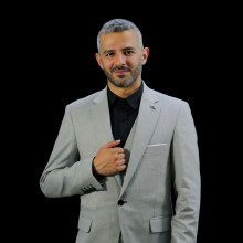
Ibrahim Ibrahim

Eng. Ibrahim is a distinguished expert in telecommunications engineering, with more than 16 years of experience in the design and planning of telecommunications networks.

Eng. Ibrahim is a distinguished expert in telecommunications engineering, with more than 16 years of experience in the design and planning of telecommunications networks, including wireless networks, fiber optics, and microwave technologies. He led strategic projects with leading companies such as Huawei, and contributed to the implementation of DWDM networks and IBS/DAS systems. He has in-depth technical insight and professional management skills, and uses tools like iBwave Designer efficiently. He oversees technical solutions in Saudi Arabia and is considered a trusted reference in the industry.EXPERIENCE Company Name: stc Optical transport design advisor DWDM Consultant | Jul 2025 - Present · • Designed and implemented optical transport networks for DWDM and SDH, enhancing capacity and reliability. • Led migration and expansion projects, integrating existing networks with new initiatives to optimize pe rformance. • Collaborated with cross-functional teams to ensure seamless project execution, resulting in improved service delivery. • Contributed to stc's growth in the telecommunications sector, reinforcing its position as a market leader in Saudi Arabia. Company Name: Detasad Dwdm Network Architecture Consultant Network Consultant | Jun 2023 –August 2 025 • Provided technical oversight in IP/MPLS and DWDM projects.• Ensured quality assurance and that all components meet quality standards.• Prepared the RFP for complete solutions and projects.• Interviewed vendors and evaluated solutions to propose the best options.• Supervised on-site acceptance testing (ATP).• Analyzed and coordinated network design and solutions with account managers.• Managed and administered technical issues for customers as part of a team.Company Name: HuaweiTechnical Director | 2019 - 2023• Leading DWDM LH/Metro projects for STC optical transmission (more than 1350nodes) and Zain optical transmission (more than 460 nodes).• Assisted with the preparation and control of production budgets; maintainedinventory and ordered specialized supplies.• Led technical week rehearsals to supervise and assist in the technical aspects ofmounting shows.• Maintained accurate documentation of project progress.CERTIFICATIONS• PMP, RMP, SP from PMI – Certified Project Manager• iBwave L1, L2, and L3 (Certified)• 5G HCIA/HCIP (Huawei)• Wireless 2G/3G (Nokia) / 4G HCIA (Huawei)• GSM Expert (Ericsson)• Fixed Transmission (DWDM) (TX) (HCIA)• Cybersecurity (Huawei)• 3G/LTE Optimization (CommScope)• Train the Trainer (TTT) Huawei• PCC (Huawei)• Train the Trainer Certification• Network Products Hardware Installation Certification• Preposition Maintenance Certification• Single DAS and Campsite Certification from Huawei China
$119

Lectures

0

Category

Telecom courses

Publish date

5 November 2025

Expiry period

Lifetime

Share this course

Related courses